

Abandoned Villages of Cyprus (EN)
- Constantinos Koushiappis
- Dec 11, 2015
- 10 min read
I was having a discussion with my friend Achilleas, about the Motorcycle tours he organizes, via his company, EuSouth&East Motorcycle Journeys, and he told me about a trip to some forgotten and abandoned villages in Cyprus.
He asked me if I could help him complete this tour since it would require passing through dirt roads that might be difficult to get through for the heavy on/off bikes that participated.
Of course, I accepted because I was looking for a chance to esxape from the daily routine and familiar routes. It was also an opportunity for me to try and ride outside my comfort zone, with the panniers and more load than I'm used to.
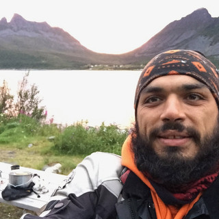
The big day came, I loaded the motorcycle with all that was necessary for an offroad trip and started early to meet Achilleas and Souli to where we arranged.
The atmosphere in Nicosia was suffocating, with a lot of fog and no visibility. There was so much humidity to the point where you could not close the visor of the helmet because everything would get blurry.
We took the highway for Choirokitia where would be the beginning of the adventure.
The first dirt road came up quickly, and we easily passed through it with very slow speeds, due to the large passenger-carrying on/off motorcycles. And so we arrived to the first two villages of the trek.
Precious metals were found in the mountains of Kalavasos area.
Two villages were created during the Venetian rule, which housed the miners. These villages were Parsata and Drapia.
Both of them are built along the valley of Vasilopotamos ("Royal river")

Parsata village is located just 3km east of the village Lageia.
The settlement, according to the findings, seemed like it was built to last. In the surrounding fields there are huge carob and olive trees, which reveals the intention of the village residents for permanent and continuous stay in the area.
A few kilometers further lies Drapia
Drapia village, that bears the name of the administrative circumference of South Italy, is a residue -"monument” of the Venetian Era in the island of Cyprus. It is built northwest of the village of Kalavasos.
Both settlements share the same story and the same fate. They were built almost within the same chronological period and both of them for the same reason. They were abandoned for the same reasons, as well.
As years went by, the mountain had nothing more to ooffer. The miners were left without a job and without a choice. They had to leave their houses behind, take their families and head to other territories where they could find work. Some of them went to Amiantos village and others to Mitsero village.
We headed for Pafos district through the motorway so we could save some time.
We would continue our trek to the rest of the villages after Kouklia village which was our first stop for coffee as well.
After we got some rest we took a dirt road just outside of Kouklia village that brought us just above Souskiou village.
Souskiou is located in the northeast part of the valley that Diarizos river had formed over the years.
During the Ottoman Era of Cyprus, Turks choose to build their villages in valleys that were fertile because of the rivers crossing them. So the beautiful valley of Diarizos, with its huge arable lands, was inhabited entirely by Turks.

In the village of Souskiou, the wealth and welfare of its residents is a prominent feature. In every neighborhood there is a fountain with drinking water.
The architecture of the houses varies depending on the time when each house had been erected. The oldest are built with huge irregular stones, coated with clay. While the houses built after the Ottoman period are built with square bricks, which villagers made themselves, from clay and straw.
In the years following the independence of the island, the houses were built with bricks.
The mosque, located in the center of Souskiou is the only building that is in good condition.
During the first years of independence, Souskiou was part of TMT's terrorist training. The village, well-hidden in the valley of the river, away from the eyes of the police, was the perfect place where disruptors could be trained on weapons, which they then turned against the legitimate authorities of the island.
In 1963 began the abandonment of the village. By 1974 the streets of Souskiou were empty. Today they only living creatures that moves through the cobbled streets are some pig "families".
We continued to ride along Diarizos valley through dirt roads, to the next village, Maronas.
During the Frankish period the village was very rich, and was one of 14 villages in Pafos that made up Little Commandaria of the St. John Knights, which had its headquarters in Foinikas village.
Maronas must have been a very big village, as well, because the Latins had established a religious center there, by creating a Latin Catholic Diocese.

No one knows when and how the village became Turkish and Muslim from being Maronite and Christian, but if we follow the historical events, we can assume that the village had changed identities after the Ottoman conquest of Cyprus.
In 1960, the village had 11 Christians amongst 100 Muslims.
Maronas survived until 1963-64 when its inhabitants abandoned their homes to seek safety during the intercommunal violence that broke out between the Greek and Turkish communities on the island.
We continued along the valley Diarizos, traveling to Trozena. The first thing that catches a visitor's eye is the green landscape that Diarizos formed.
In Trozena all homes have turned into ruins and the only building maintained in good condition is the church of St. George, which was built in 1885 and restored in 1993.

We walked into the village, which gave us the impression that the inhabitants fled in haste. Potted flowers were placed at the entrances of houses and some homes still had chairs and tables in their yards.
A house was closed off with a gate and it seemed that the owner was planning to renovate, possibly to use it as a cottage or holiday home.
Walking down the street to go to the church of St. George, an amazing view welcomes you. A natural spring surrounded by huge trees that can offer coolness and shade for rest. There is also a bench to sit.
Information says that the village was abandoned some 20 years ago.
Characteristic of the village is the old metal bridge with the wooden top, which can hold vehicles weighing up to eight tons. It was designed by an English engineer that served in the English occupation army.

We continued on a paved road, passing the nearby abandoned village of Gerovasa, which had almost the same story with Trozena, and we got to the village Choletria which was destroyed by an earthquake in 1953 and was rebuilt a few kilometers farther, but unfortunately we had no time to stop.
While passing through this village it's almost impossible not to notice the old church.
The most difficult routes of the day came up on our way to the village of Foinikas. It's one of the most famous abandoned villages of Cyprus to which access is almost impossible in rainy periods because of its location.
It is located northwest of the dam Asprokremmos in Paphos. And there are only two ways to reach it.
From Nata village the dirt road is smoother but it passes through the bed of Xeropotamos( Xeros river) for 200 meters. This means during rainy periods it cannot be accessed.
From Anarita village there is a very difficult and uneven path through a very steep narrow dirt street which "floats" on the verge of the towering cliff that ends in the deep waters of the dam. This road goes through a small stream, which is covered by reeds and wild vegetation.
Fortunately Xeropotamos had no water in it the day we chose to go and so it was the best way to and from the area.
The story of the Foinikas begins in the era of the Knights Templar and ends in about 1960.

In 1191 AD, King of England Richard the Lionheart invaded the island of Cyprus.
After defeating the Byzantines, he plundered the island and sold it to the Poor Fellow-Soldiers of Christ and of the Temple of Solomon, or widely known "Templars" or “Templar Knights”.
The Templars founded the superior military command of Foinikasin order to control and govern the provinces of Paphos and Limassol.
The village of Foinikas continued to "live" until the island's independence in 1960. The independence didn't bring only good things along with it, it brought urbanization as well.
Dozens of villages were abandoned and ruined. Among them was Foinikas.
We followed the road through the Xeropotamos to get the secondary road that would take us to Yeroskipou where we would stay overnight.
After an incredible night in the company of the small hotel's owner, Mr. Fitos, that surely none of us will forget, we went to bed with the promise of Achilleas that difficult paths hadn’t come yet and that the following day would be much more demanding in terms of off-road riding.
Our second day started from the early morning hours, and found us enjoying a coffee at the hotel. After we collected our stuff and loaded them on the motorcycles, we took off.
My obligation was to stay at the back as a "cleaner" and to assist those who needed help in difficult parts of the route, and anyone who generally had a problem, but also to inform Achilleas of any problems and delays that occurred at the end of the line.
We left Yeroskipou and headed to the first village of the day.
Before we even managed to get into real dirt roads the first stop of the day was a fact.
I saw Costas and Elena looking down towards their wheels as if they heard some noise coming from them.
We stopped to check it out, but eventually we didn’t exactly find what was wrong, and so we decided to move on to catch up with the rest of the group.
Some kilometers farther, the noise had stopped completely and was not a problem.
The road had begun to bare its teeth at some points. Dimitris’ Crossrunner could not go through due to its height, so Eleni, who was riding at the back, had to get off the bike on several occasions in order to have better control over the bike.
We arrived at Moronero!
Moronero settlement was part of the Kallepia community in Paphos.
It was a small, mixed village, eventhough Turkish-Cypriots were always the great majority.
In 1960, Moronero had only 42 inhabitants.
In the early 1960s an intercommunity conflict broke out between the Greek and Turkish communities in Cyprus, which had affected Moronero and contributed to its isolation. Its inhabitants abandoned the village, looking for a safer place.

The first thing one will face is a ruined Christian church. Around the church the soil is dug in such a way that gives the impression that over the years the church had been buried and dug up. Half the roof is missing and the other half is supported by scaffolding. Inside there is an image of the Saint after which this church was named, a couple of lamps and a small, low altar made of jagged stone.
This is the church of Saint Gennadios, the 21st Ecumenical Patriarch of Constantinople, who abandoned his throne and came to this part of Cyprus in search of the hermitage of St. Hilarion the Great, and chose Cyprus as his ascetic retreat.
Information says that when he died, the people carrying his coffin stopped to rest at the place where now stands the chapel, so they had put the coffin down. When they tried to pick it up again, it was so heavy they couldn’t move it. So the burial took place in that area and then the chapel was built.
We continued our trek to other inaccessible places. Our speeds were reduced for good, due to the mud holes that began to appear before us.
Theletra is located twenty-seven kilometers away from Paphos.
Theletra was abandoned after the occurrence of a big earthquake, followed by rock and soil landslides that destroyed most of the houses. The village was built at the bottom of a hill which had subsided. The new village of Theletra was built on the top of the hill.
The road to get there, although asphalted, is not easy due to landslides.
In old Theletra still exist some houses, which were fixed and inhabited.
Walking through the streets of the village, we could enter some of the houses that actually have a story to tell.

Books were forgotten, empty cognac bottles left on the counters and jackets were hung on walls; all let at the mercy of dust and dirt, would make you think that the village was abandoned in haste.
We followed the road that leads out of the village, which was covered in mud, and slowly we found a clear road. We had our coffee-and-relax stop, and then marched to the dam of Evretou.
The village of Evretou was Turkish-Cypriot, located on the banks of the dam and has been deserted since the invasion of 1974. By 1960 Evretou had 125 inhabitants.
The only building that is maintained is Evretou Mosque which was built in the early 20th century on the main road of the village and was selected to be part of the Commission's emergency program for Cultural Heritage.

Somewhere there we had the group’s first fall, since George had lost control of the rear wheel trying to pass through a muddy puddle with a passenger.
After a first class mud bath, we helped him get the motorcycle out so the others could pass through as well.
Right after Evretou a second fall occured into another inconspicuous puddle of mud, which wasn’t clearly visible due to the reeds around it.
Kostas with his V-Strom was the second “victim” of the mudhole. Thankfully there was no other passenger on the motorcycle.
We continued through a field, to find the road that would lead us to Sarama.
Sarama was a Turkish-Cypriot village which was completely destroyed by an earthquake. Information says that many residents had abandoned it due to the destruction of their crops in 1879.

We continued three kilometers beyond to the village Kios, or Istintzio.
Istinjo was a Turkish-Cypriot village and was abandoned in 1974.
The few houses that are still standing are being used by farmers of the area for storing their tools and animal feed inside.
Going up the mountain, we passed the village of Zacharia, which was abandoned by its Turkish-Cypriot inhabitants in 1974. Up until 1973 the village had 113 residents.
We arrived in Melandra which was destroyed by bombings in 1974. The only buildings that remained intact are the Orthodox church of St. Nicholas and the mosque, which are located side by side in the village square.
The surrounding houses were turned into ruins, so the village was not reconstructed again.
Last village of the trek was Statos.
Statos was destroyed by landslides after heavy rainfalls in the years between 1966 and 1969, and so in 1973 the first residents began to settle in the new location a few kilometers east of the mountain top.
After the events of 1974 the new settlement of Statos hosted many refugees from the occupied areas of Cyprus.
The trek to the abandoned villages ended with the best impressions. Hidden treasures, forgotten in the mountains. Villages that once were full of life and bustle, are now standing deserted and quiet to remind us that nothing is permanent and nothing lasts forever.


Comments